Saturday, June 23, 2012

Walk 24: The Sandy Spring Quakers and the Underground Railroad

If you're sniffing around for history on dog walks, you don't get much bigger of a prize than finding out you've just uncovered one of the main causes of the Civil War. Or so they say.


In the run up to the Civil War, Montgomery County developed a reputation as a pro-slavery area. This wasn't necessarily out of step with Maryland in general given it is below the Mason-Dixon line and was a slave holding state. One of the big reasons Maryland didn't secede turned out to be the small matter of Abraham Lincoln throwing 13 pro-South state delegates in the slammer just before a crucial vote on the manner.

However, as with everywhere else in the country, things were never cut and dried. While most residents supported the South, the Quakers didn't. They settled in the Sandy Spring area around 1745 and by 1777, they decided slavery was immoral and freed their slaves. This created a community of freed blacks and Quakers right in the heart of Montgomery County and, as these things happen, set up a crucial stop on the Underground Railroad that smuggled escaped slaves North.

 What Sandy Spring turns into below

Now I don't know if it is true and apparently neither does the Montgomery County park service, but the story is that one of the former slaves that hid in the Sandy Spring area was none other than Dred Scott, the slave who claimed his freedom after reaching the North. The Supreme Court ruled against him, which didn't mollify the South, but did succeed in enraging much of the North.


At Woodlawn Manor Park, the county has set up a two-mile interpretative trail which points out some of the aspects of the Underground Railroad such as hiding out and following the North Star at night. This 2 mile trail wasn't an actual Underground Railroad trail. No such thing exists. It's just supposed to show how it worked. In their description, the park service refers to "rumors" Dred Scott hid in Sandy Spring. A quick web search of Maryland archives also cites "tales" of Dred Scott being somewhere or another in Montgomery County under the protection of the Howard family. What is clear is that Montgomery County supported a thriving community of slave-catchers since our northern state line is the split between North and South. 

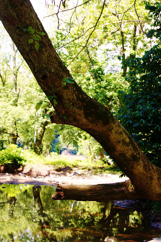
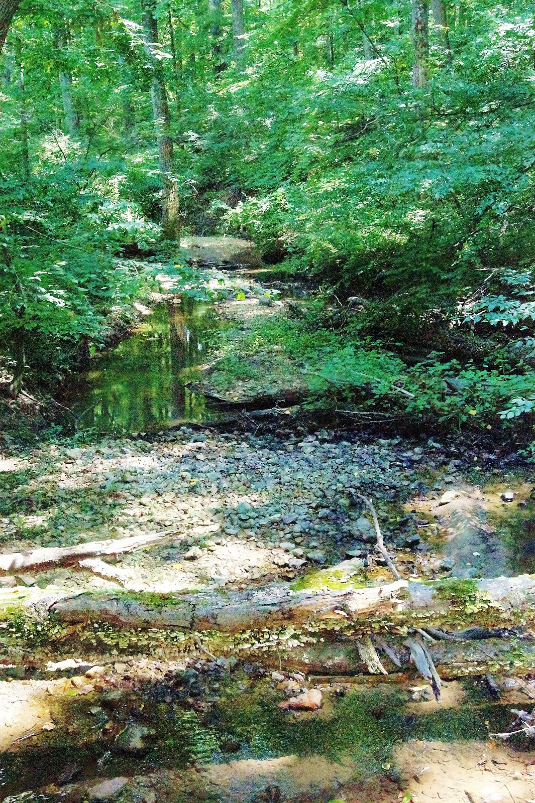
History aside, this walk is roughly split between a mile in the woods and mile along and between cornfields. If you want to get a glimpse of what the county looked like a hundred years ago, this is about as good a place as any to do so.

 
 A beautiful and highly unusual stone barn built in the 1830s. Most were of wood but this was built to last. Now it houses park service horses at Woodlawn Manor.


This Groundhog has his own underground railway.

Practical information: Drive to 16501 Norwood Road, Sandy Springs, Md, to find the entrance to the Woodlawn Manor Park. The underground railway interpretative trail starts to the right of the main parking lot. On weekends, guides give free tours and talks of the trail.
Trail length is 2 miles, round trip 4 miles.


Friday, June 15, 2012

Walk 23: Block House Point, Muddy Branch Greenway

Back to Block House Point Park and since I have written up the rich history of the park a couple of times, I'm going to skip right over that.

This morning's walk, the Muddy Branch Greenway Trail, started off with everything going against it. The trail paralleled River Road for a quarter-mile and high speed cars and scenic walks go together like sand in your bathing suit. But then the trail shifted and plunged into the woods and everything changed.

The woods along Muddy Branch are beautiful

At risk of being arrested and sentenced to wear Birkenstock sandals and drink celery juice for the rest of my life, I think every patch of forest has a different character even if they are made up of the same trees and what not. And the forest in this stretch of the park was on the best stretches of woods I've been in for a while. Of course, not everything can be conveyed in a photo. You don't hear the Mourning doves or the Barred owls calling. You can't know it was 68 degrees this morning which is about as good as it gets for walking. But this is one great trail. Also, not another soul on it since it is across River Road from the main section of the park.

Or, if I wanted to be supernatural about it, this is also where thousands of Union troops camped and since twice as many soldiers died of disease as in battle, this is a section of woods with a lot of souls.

The trail links River Road and Ellsworthy Road, a distance of about a 1.5 miles, and meanders along side Muddy Branch before veering off to follow the edge of the Colonial pipeline cut. The track is always either uphill or down which, in my view, makes it more interesting than just a flat walk.

Portions of the trail skirt the flood plain connected to Muddy Branch giving you a chance to see some nice wetlands as well.

This morning's surprisingly excellent walk came about as a default. I had tried to find a good walk somewhere in the Silver Spring to Bethesda arc, but there aren't that many.

As I walked, I thought about this and realized they were there once, but during the 1950s and 1960s, they were lost. Yep, back then developers took one look at creeks and streams saw a problem. They ripped them out by diverting them and filling the stream beds with concrete so that they could build houses right alongside them and not worry about the flood plain issues. In retrospect, it's hard to imagine a more brain-dead, flat-out stupid approach. Building these concrete culverts must have been wildly expensive not to mention the loss of the amenity of good parks.

This was once a free flowing stream in Bethesda. Note the house right on the old banks.

This is why most of the long, great walks are concentrated along the Potomac in a large arc in what we call the Up County area which still has a rural flavor. By the time the developers got to this area of the county, the environmental movement or just plain common sense forced them to leave the creeks as they were.

The 1950s and 1960s had a lot going for them, no doubt. But not when it came to building and development. Sadly, it's probably not possible to restore these lost creeks.

What should be flowing through Silver Spring and Bethesda.

Of course, like anything else, there are exceptions such as Rock Creek and Sligo Creek. But having seen what a good washout does to these creeks during a hurricane, the only thing that preserved them is their ability to rise and really flood the surrounding land.


Leave the woods and leave out the sidewalks. It only makes sense when it comes to the creeks and their flood plains.


Thursday, June 14, 2012

Walk 22: Cabin John Creek At Tennis Courts, Section 4

The fourth section of the Cabin John Creek Trail doesn't have any history to it that I know of, but it is a scenic walk in the woods. This trail, which starts behind the year round tennis facility on Democracy, links up to Tuckerman Lane, about 1.7 miles away.

A panoramic creek shot


This is also a very popular dog walking spot and during one section of the trail, we came across three other dogs being walked. Interestingly enough, I've never had any trouble on the trail with dogs fighting each other, and I'm not sure why. Loki doesn't start fights because 1) he's sort of cowardly and 2) being a Border Collie, he's obsessive-compulsive about fetching tennis balls. He takes the simple game of throw and fetch and makes it into a major triathlon event.

 Loki hurdles a log after swimming for the ball and just before scaling the steep embankment. Borders are definitely have OCD.


This reminds me of a Border Collie breeders comments to me when I was first talking about getting a Border. He remarked Borders are the sort of dog who will lie on the floor staring at a tennis ball for half an hour. Oh sure, I thought skeptically. That is until Loki started lying on the floor staring at a tennis ball. Of course, he knows that if he does this, it causes me to feel guilt so I kick the ball across the living room and he's off amid loud clawing sounds on my hardwood floors after it. Yep, that dog has me well trained.


A little more than half way to Tuckerman Lane, the trail crosses a wide open swathe of land which belongs to Pepco, our local, unreliable electricity provider. If you head to the right on this right-of-way, you wind up in a big parking lot where Pepco keeps its bucket trucks. To the left, you can walk about a quarter of a mile until you hit a washed out bridge.

Montgomery County Parks is apparently sick of getting phone calls about this bridge because they have posted a sign saying the bridge belongs to Pepco and if you are curious about when it will be fixed or if it will be fixed, call them.

Pepco's bridge says all there needs to be said about this utility company's reliability.

I always find it fascinating though when nature starts to colonize industrial areas such a high tension power line clearing and this one is no different. Right next to some smaller lines is a beautiful marsh.


This marsh has developed under the power lines complete with cattails and Blue Heron.

Walking under the power lines on a hot August day is a good way to get heat stroke but in June, when DC is still habitable, the cut is a great place to spot wildlife. This morning, a buck cut across it and before, I've seen red foxes courting.

Practical information: Park at the year round tennis court facility on Democracy Boulevard. Trail to Tuckerman Lane is about 1.7 miles, or 3.5 miles round trip. Several variation trails link up to the main trail but since they all come back to the main trail and are less that a quarter mile, I;m not going to list them separately.


Wednesday, June 13, 2012

Walk 21: Seneca Aqueduct, Washington Slept Here, and Stuart's Great Blunder

Whew! When you hit the Seneca Aqueduct at Riley's Lock on the C&O Canal, get ready for an avalanche of history.

What's left of the Seneca Aqueduct after the September 1971 blew out one of its arches.

To start with, this is the site of the Seneca Quarry which produced much of the sandstone used in the construction of the lower reaches of the C&O Canal. But even before this, quarry work went back to the Revolutionary War period and the cut stone was floated down the Potomac to Great Falls before being shunted onto the Seneca Canal, a forerunner of the C&O, as a bypass to the rapids. George Washington was a frequent overnight visitor to the quarry so you can say "Washington Slept Here."

What the Aqueduct looked like before the 1971 flood.

The stone aqueduct carried the C&O canal over Seneca creek where the now broad and deep creek flows into the Potomac and was maintained by the Riley family for long enough the lock here is named after them.

But more importantly, this is a spot where the Potomac is both broad and shallow, a great place if you wanted to ford it with a wagon.

Which is exactly what Confederate cavalry general J.E.B. Stuart did on June 24th, 1863. Two days earlier, Stuart had been staging a review of his troops at Brandy Station, Virginia, for the local ladies when a Union cavalry force joined the festivities. Stuart's men drove the Union forces back across the river in the largest cavalry battle of the war, but Stuart didn't take kindly to the audacity of the Union gatecrashers.

He requested permission from Confederate commander Robert E. Lee for a retaliatory road into Maryland just as Lee started moving his army across the Potomac. Admonished that the cavalry's main job was to act his "eyes and ears," Lee turned Stuart loose. It was the last time Lee would hear from Stuart before Lee ran head on into the Union Army at a small Pennsylvania town called Gettysburg. No one thing determines the course of a battle, especially not a three day slaughter like Gettysburg, but Lee did go into the battle with little knowledge or where his enemy was. The Union army won the battle and Lee lost his one last big chance to end the war.

Where the heck was Stuart during this time? Well a lot of places because he rode completely around the Union army before rejoining Lee's retreat into Virginia, but after crossing the Potomac at Rowser's Ford, he wasted time wrecking the canal and then marched on Rockville, the county seat of Montgomery County.

J.E.B. Stuart left Lee blind when it counted. The rest, as they say, is history.

Once in Rockville, Stuart captured 125 Union supply wagons and then tried to drive the booty back to Lee. Slowed down by the wagons, he never caught up.

You could probably pick a lot of places where the South lost the Civil War. Rowser's Ford at Riley's lock won't be at the top of the list but it's certainly on the list.

Once you cross the Aqueuct, Loki and I took the first right off the towpath, a dirt road. This leads to the ruins of the Seneca Stonecutting Mill. Powered by water from the canal which was then diverted into Seneca Creek, this mill cut the stone quarried at Seneca Quarry.

What's left of the Seneca Stonecutting Mill.

Stone from this mill wound up building a number of buildings in Washington DC but the most famous is the original Smithsonian Museum, what's colloquially known as the Castle of the Mall.


The Castle


I couldn't find any historic photos of the stonecutting mill but the Library of Congress has these elevation drawings.

Under water power, the mill featured to eight foot band saws that could cut the rock at a rate on one inch per hour. Later, the mill upgraded to a turbine for electricity.

From the ruins of the mill, follow the road up to River Road, a 1 mile walk, that follows Seneca Creek. This is mile one of the Seneca Greenway Trail and if walking on a road sounds a bit unexciting, it is a gravel road and scenic which makes up for it.

 The mile walk to River Road.

When you reach River Road, you will see right across fromn you Poole's General Store. Opened in the mid-1800s, this General Store is the oldest, continuing operating General Store in the County.


Poole's General Store was operated by the AllNutt family for over a hundred years before Poole took it over. 

I wouldn't let this photo fool you too much. The county, with it's million residents, shops pretty much at Target and what not.


 Riley's Lock also serves a base for the Calleva outdoor education camp and here a small campers are being paddled out under the Aqueduct to the broad reaches of the Potomac. The campers were singing so it sounded like they were having a good time.


Other more recent history comes in the form a request by the National Park that fishermen do them a favor by killing any Northern Snakes heads they catch in the canal.


These voracious fish, which are native of China,  were released into a Maryland lake a few years ago. Not only are they eating virtually every other fish in our waterways, but they are spreading because of their ability to walk short distances on land. Maryland, which abolished the death penalty, makes an exception for these fish.


Maybe all the Snakeheads being killed in the area is what is keeping this Black Vulture hanging around.


Monday, June 11, 2012

Walk 20: The Muddy Branch Trail, Home of the 19th Massachusetts

If you look closely and have a lot of imagination, you might just see the shade of Robert Shaw under this massive Sycamore tree.

This tree might have shaded Union troops in the Civil War.

As I mentioned in my first post about Block House Point Conservation Park, Robert Shaw was stationed here in 1861 along with the 19th Massachusetts Regiment with the job of stopping the Confederates from burning the locks on the C&O Canal. Shaw rose to fame when he took over command of the 54th Massachusetts Regiment, an all African-American regiment featured in the movie "Glory."

But Shaw didn't much appreciate his stint doing guard duty for the canal and called the encampment along Muddy Branch the worst camp he had ever seen. Considering this was at the beginning of the Civil War, perhaps he later on found others even less becoming than the damp and marshy ground here.

It's not too difficult to figure out where the Union encampment must have been. Afterall there is only one area of broad flat land along the creek that is just before it meets the canal itself. In fact, the swathe of level ground is a flood plain and more than one encampment must have been washed away during our September hurricane season.

To reach this spot, Sarah and I started off with Loki at the middle, and largest, parking area and followed the old River Road track for about 1.25 miles until it joins up with the Muddy Branch trail which is really an access road to the Washington Aqueduct.

The Muddy Branch trail.

Of course, since Muddy Branch is cool running water and it was a hot day, you couldn't have kept Loki out of the creek if he'd been tied to wild horses. No sooner than we reached the access road but he disappeared down the embankment.


Come on in, the water is great!

We followed the access road until it dead ended amid some aqueduct equipment and from rank swamp smell coming up from the pipes, I'm glad that water gets treated before it reaches my taps.

Just before this dead end, is a bridge over Muddy Branch that leads to a path up to Pennyfield Lock, the place Grover Cleveland liked to bass fish.


The Muddy Branch bridge.


Practical information: Take River Road towards Poolesville. Once you pass Pennyfield Lock Road, keep your eyes on the left hand side. The main parking area is the second parking area and is marked with a sign. The walk along old River Road down to Muddy Branch and onto Pennyfield Lock is about 1.5 miles, 3 miles round trip. Going towards the lock is gentle downhill all the way and coming back is the opposite.

Saturday, June 9, 2012

Walk 19: Seneca Creek Greenway Trail, Berryville Road Area

The Seneca Creek Greenway Trail, a 14 mile trail that links Clopper Road and the Potomac, is, according to Loki, a trail filled with monsters, such as this box turtle.

Loki rushes the monster before springing back to safety.

Well, okay, so a box turtle doesn't really qualify as a monster but if you are enough of a coward, you can scare yourself silly over just about anything. Which more or less describes Loki. At the first hint of thunder, he's down in the basement in his sleeping crate looking around with a paranoid expression. I've told him a hundred times we don't really get tornadoes but he doesn't believe me. Either that or he figures there is always a first time and our house has a bulls eye on it.

Loki steeled himself to sniff the turtle a couple of times before jumping back as if he were tangling with a 35 pound snapping turtle and then when it did nothing but peer out at him from its shell, he got bored and wandered off.

As a kid, we used to keep box turtles as pets during the summers feeding them tomatoes, ground beef and lettuce and then dropped them off back where we found them in the fall. But the weird thing about box turtles is you can never find them when you go looking for them. You only find them by chance when you are walking in the woods. All very Zen, no doubt.

Loki and I hiked a section of the Seneca Creek Greenway trail from about mile posts 4.5 to 2.5 which links to the two parking areas on Berryville Road. Despite the name, much of this section of the trail meanders through second growth woods with nary a sight of the creek itself. Although most of the trees are less than a foot in diameter, I did spot what a forester once told me was a "wolf tree."

Back when these forests were being clear cut for charcoal and what not, the loggers would periodically leave behind an oak with a full crown because it would help reforest the area with its acorns. This tree must have been 6 to 7 feet in diameter and its crown was nearly a full circle. I don't know enough to date trees by sight, but I would imagine this one probably shaded a few Union troops during the Civil War.

A wolf tree. You can see how much more massive it is compared to all the other trees.


The trail, which follows one of the boundaries of Seneca Creek State Park, also swerved out of the woods and through some abandoned hay fields. This is where we found a whole swathe of native grasses. Among other things, Maryland is trying to restore some of the native plants and the native grasses the settlers found were some of the first things to go. Farmers replaced the tough native grasses with timothy and orchard grass so they could get two cuttings of hay off their fields. Unfortunately, they also wiped out the quail while they were at it because that's a ground nesting bird and the cutting bars went through the nests on the June cutting.


Six foot high native grasses dwarf Loki.


You can always spot the native grasses because they grow higher than six feet, much higher than timothy or orchard. Anyway, I have some hay baling in my background and so far in life, this is the first time it's been even remotely useful to me.

The other point of interest in the walk is that it takes you through some abandoned  hay fields which the forest is slowly reconqueror and just beyond the park boundary are working farms.


 An abandoned hay field overlooking a farm
 

Yep, even with a million residence, Montgomery County still has some rural spots although these are getting squeezed by rising land prices.

By mile three and without a single swim to cool off, Loki was dragging tail for sure. I hadn't really realized what that saying meant, but when he gets hot, he moves slower and slower until he's more or less underfoot on the walk and his tail is about as low as it would go.

Fortunately, that's when we rejoined the creek which at this point is pretty fast moving. Normally, being more or less a chicken, Loki won't tangle with fast water, but when you're hot enough, anything looks good. Or maybe the sun had gotten to him.

Loki finally gets a chance to cool off.

Now, a lot of people I come across on my walks not only are familiar with Border Collies, but they've heard that Border Collies are supposed to be smart dogs. I usually let these comments pass because while Borders may be smart dogs, they are still dogs. And one of the things Loki doesn't quite get about life is gravity.

In his case, he's so overexcited to chase after the tennis ball, he drops it ten feet from me instead of at my feet. Works fine normally, but if that ten feet is on the edge of a stream embankment, gravity takes over and the ball rolls back into the creek. And I'm not about to clamber down some mud bank after it.

I tell Loki "Find the ball!" which means bring it back up for another try, why don't you. He can do this six or seven times before he figures out he has to drop the ball on level ground.

As I say, Borders might be smart, but they're still just dogs.

Practical information: Drive out River Road towards Poolesville and take a left on Seneca Road and left on Berryville Road. There are two parking areas at roughly mile posts 2.5 and 4.5. One way is two miles round trip about 4 miles.

Thursday, June 7, 2012

Walk 18: Cabin John Creek Section 4 and How'd It Get That Name Anyway?

Loki and I bump into deer fairly regularly on our walks, and because deer are creatures of habit, usually in the same places too. The Cabin John Creek trails between River Road and Bradley Blvd from Bradly Blvd to Democracy are two trails where we can count on seeing white tails.,

There's a doe in there somewhere.

This shot of a doe was taken on the 1.7 mile walk between between Bradley and Democracy. This is one of my favorite walks because not only do you have the creek on one side but the trail branches off and goes up and down several hills. In any case, there's plenty of time to wonder about things such as how did the creek and community next to it wind up with the somewhat weird name of Cabin John. Why not John's Cabin.

The truth is, no one really knows now how the name got stuck on the area. One theory is that there was a hermit named John who lived in a cabin. This strikes me as the least imaginative and least plausible.

The creek with the funny name.

The next idea  that gets kicked around is that Cabin John is a misspelling of Captain John and there are two candidates for this role. The first is Captain John Smith, the founder of Jamestown, who sailed up the Potomac in 1608 as far as Great Falls where the rapids blocked his way.

This is how Captain John described the area "Having gone so high as we could with the bote, we met divers savages in canowes well loaden with flesh of beares, deere, and other beasts whereof we had part."


Clearly, spelling was much more fun back in 1608. In any case, as you can see from the top photo, the deer are still here even if Captain John has passed on.


The second candidate for Captain John is a pirate captain who fled from his crew and buried some treasure in the area. Not to be a wet blanket, but I've sort of noticed that there isn't a square mile of the East Coast that doesn't have a pirate story connected to it. Either there were several million pirates roaming around back in the day or someone is making stuff up. Coming a bit closer to our time, the area of Cabin John was mostly tobacco farms until 1912 when a development company snapped up one of the farms and subdivided it. They included a clause in their contracts that any pirate treasure found on your lot had to be split 50-50 with the land company. Whee! Now that's a sales gimmick! For the record, nobody found pieces of eight under their houses or if they did, they forgot to tell the land company.

What we do know is that in the mid-1700s when Lord Baltimore owned the Maryland colony, he was passing out land grants to his friends, and in the records, Cabin John Creek is called Captain John Run or Captain John Branch.

Captain John, whoever he was, would recognize this landscape. With our forests grown back, it looks a lot more like 1608 than 1908 when the area was clear cut. 

Practical information: Out Bradley towards River Road. Park in either small parking lots on side of Bradley. The trail is about 1.3 miles so plan on 2.6 miles round trip and it is somewhat hilly. Deer tend to wander around in the floodplain where the creek makes an oxbow. 

Wednesday, June 6, 2012

Walk 17: Cabin John Creek Section 3 and the Potomac

I always like to say that the worst walk in the woods is better than the best walk around the block but this section of the Cabin John Creek trails sort of strains that saying.

A noisy walk when you go under three major roads.

The main points of interest in the walk are that it finishes up Cabin John Creek because you can wind up on the shores of the Potomac and Cabin John Bridge. Whether that offsets the noise you wind up with as you pass under three major highways is another matter. That and all the graffiti beneath the bridges.

At the moment, with all the leaves out on the trees, you can't really get a good look at Cabin John Bridge so I'm going to use this historic photo as my main illustration. Again, it's interesting to note how denuded the land is of trees. Although the bridge does carry one lane of traffic on MacArthur Blvd now and is a major bottleneck in rush hour, it's purpose wasn't really for commuting. Instead, the bridge is part of the Washington Aqueduct and was started in 1853.


The bridge under construction.

The problem faced by Washington even back then was that the city had thoroughly polluted the Potomac every where that was close by. So engineers built an aqueduct to draw water down from above Great Falls where the river ran a bit cleaner. I say a bit cleaner because even back then, I would have boiled the water before I touched it.

The walk dips under the three bridges and if you follow it, you will walk across the underpass where Cabin John Creek actually flows under the canal.


Where Cabin John Creek flows under the C&O Canal.

Just beyond this point on the trail, you can cross the canal on a footbridge and if you turn left, you can rejoin the creek on the far side the canal. An informal, unmarked trail follows the bank of the creek until you reach the Potomac.


Yep, that's the Potomac just through the opening.

My other quibble with the walk is that this route takes you to one of the less attractive areas of the canal. The water is low and much of the canal bottom is just greasy black mud. Not that Loki minds much. Mud like water is cool and he's happy in either. I sometimes wonder if he is part pig.


Loki leaves a nice mud trail in the shallow waters of the canal this point.


Muddy enough to turn his white sock markings black. Time for a bath when we get back home.


Still, there is usually always something to see along the canal. Here are some shots of day lilies and hydrangea. Where these came from is anyone's guess since I don't believe either are native to the area and I don't know who would have planted them on the banks of the canal.


But all in all, I would leave this walk for thems that enjoy dank, muddy waters such as the terrapins.

Practical information: Park on the DC side of the Cabin John Creek and follow the trail under the major roads and cross the canal. Turn left on the canal and right before where Cabin John Creek emerges from under canal, follow an unmarked, informal trail to the banks of the Potomac. Distance is about a mile one way. I would only do this trail if there were no better alternatives but it seems to be popular. Lots of cars parked by the bridge and fair number of walkers and bikers present.
Just past the start of the trail there is an unmarked trail to the left. With it's high banks, this looks to be the old route of MacArthur Blvd. After a quarter mile, it rejoins the boulevard.

Tuesday, June 5, 2012

Walk 16: Pennyfield Lock and Who Slept Here?

We've all seen them: signs over some historic looking inn with the words "Washington (or whoever) slept here." And this is Pennyfield Lock's claim to fame on the C&O Canal.

The Lock House at Pennyfield Lock.

Like Swain's Lock just downstream, Pennyfield Lock got it's name from a family that lived here for a great number of years. In addition to the running the lock, they also ran an inn across the way that was called, well, the Pennyfield Inn.


                                                  Here's a shot of the inn in 1910.                                

There's a couple of interesting things about this shot other than the old car in front of the inn. If you look closely, you can see there are virtually no trees other than a handful of scraggly ones around the inn. Now a days, this area is so densely forested it's a bit difficult to get through it all without a deer path at least to follow. I'm not sure what they used the trees for, but a lot of the area was clear cut around 1900 in massive charcoal producing operations, something I'm thankful are long past.

But so far, I haven't said who was the famous person who used to sleep at the Pennyfield Inn, have I? Well, brace yourself for it and this is earth shattering but it was Grover Cleveland. Yes, that's right Grover Cleveland. It's not much I know, but Grover Cleveland was the only president to serve two non-consecutive terms. He was elected in 1884 and then was defeated in 1888 only to bounce back in 1892. As luck would have it, the economy crashed in 1893 and that pretty much wrapped up his political career. Even kind hearted historians have trouble making old Grover interesting. One historian said he was honest and had common sense. Imagine that.

Well, one thing is for certain. He spent a fair amount of his presidential time bass fishing on the canal when he wasn't building an election history that would stump trivia players for decades.

Loki was not impressed by the discovery that Cleveland slept at Pennyfield Lock. The dog has common sense.

Once at the lock, you have the choice of upstream or down because there aren't any side trails to the towpath. Loki and I went two miles downstream and got a good look at a section of the canal that had been blasted out of the bluffs.


Rock wall after blasting to make way for the canal


But we also spotted someone else who sleeps at Pennyfield Lock and sadly this was a homeless person.

The woods between the canal and the Potomac in certain areas of the canal do have places where homeless people sleep. Sometimes when I've been following game trails through the woods, I've stumbled on the sites. They sure aren't hard to miss thanks to all the trash, plastic bottles and other garbage.

The Pennyfield Inn in 2009 when the National Park Service had to tear it down because it had become a safety risk.

Over the last 100 years, we lost our historic inn at Lock 22 but we regained all the forests that had been chopped down. We remember Lock 22 because an obscure president who used to take a break there. No one remembers the Panic of 1893 because we're still reeling from the panic of 2008.

Not that Loki cares. He just wants to cool off in the canal water and fetch a tennis ball.

 What the Park Service needed was a whole lot of these Grover Cleveland $1000 bills. Echoing his presidency, these were issued twice, once in 1928 and once in 1934.


Practical information: Drive out River Road towards Poolesville. Pennyfield Lock road will be on your left, parking lot at the end of the road. Towpath walks either upstream or downstream. I don't know of any variation walks in the area.