Showing posts with label Block House Point. Show all posts

Friday, June 15, 2012

Walk 23: Block House Point, Muddy Branch Greenway

Back to Block House Point Park and since I have written up the rich history of the park a couple of times, I'm going to skip right over that.

This morning's walk, the Muddy Branch Greenway Trail, started off with everything going against it. The trail paralleled River Road for a quarter-mile and high speed cars and scenic walks go together like sand in your bathing suit. But then the trail shifted and plunged into the woods and everything changed.

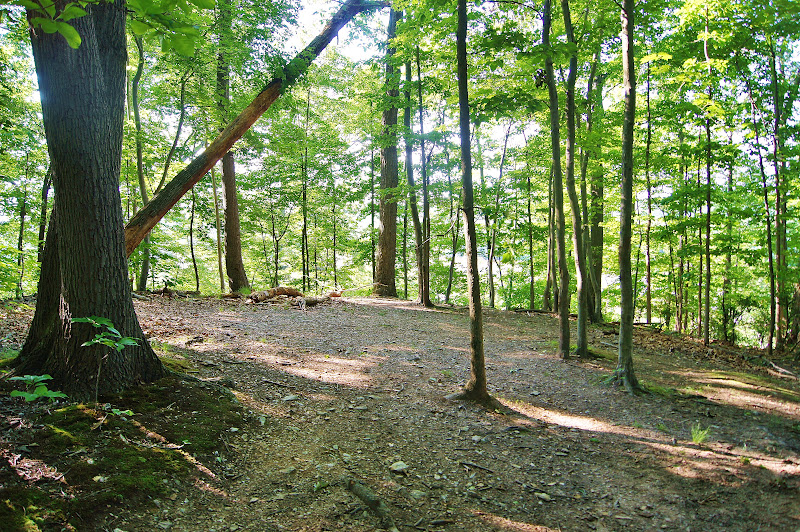
The woods along Muddy Branch are beautiful

At risk of being arrested and sentenced to wear Birkenstock sandals and drink celery juice for the rest of my life, I think every patch of forest has a different character even if they are made up of the same trees and what not. And the forest in this stretch of the park was on the best stretches of woods I've been in for a while. Of course, not everything can be conveyed in a photo. You don't hear the Mourning doves or the Barred owls calling. You can't know it was 68 degrees this morning which is about as good as it gets for walking. But this is one great trail. Also, not another soul on it since it is across River Road from the main section of the park.

Or, if I wanted to be supernatural about it, this is also where thousands of Union troops camped and since twice as many soldiers died of disease as in battle, this is a section of woods with a lot of souls.

The trail links River Road and Ellsworthy Road, a distance of about a 1.5 miles, and meanders along side Muddy Branch before veering off to follow the edge of the Colonial pipeline cut. The track is always either uphill or down which, in my view, makes it more interesting than just a flat walk.

Portions of the trail skirt the flood plain connected to Muddy Branch giving you a chance to see some nice wetlands as well.

This morning's surprisingly excellent walk came about as a default. I had tried to find a good walk somewhere in the Silver Spring to Bethesda arc, but there aren't that many.

As I walked, I thought about this and realized they were there once, but during the 1950s and 1960s, they were lost. Yep, back then developers took one look at creeks and streams saw a problem. They ripped them out by diverting them and filling the stream beds with concrete so that they could build houses right alongside them and not worry about the flood plain issues. In retrospect, it's hard to imagine a more brain-dead, flat-out stupid approach. Building these concrete culverts must have been wildly expensive not to mention the loss of the amenity of good parks.

This was once a free flowing stream in Bethesda. Note the house right on the old banks.

This is why most of the long, great walks are concentrated along the Potomac in a large arc in what we call the Up County area which still has a rural flavor. By the time the developers got to this area of the county, the environmental movement or just plain common sense forced them to leave the creeks as they were.

The 1950s and 1960s had a lot going for them, no doubt. But not when it came to building and development. Sadly, it's probably not possible to restore these lost creeks.

What should be flowing through Silver Spring and Bethesda.

Of course, like anything else, there are exceptions such as Rock Creek and Sligo Creek. But having seen what a good washout does to these creeks during a hurricane, the only thing that preserved them is their ability to rise and really flood the surrounding land.


Leave the woods and leave out the sidewalks. It only makes sense when it comes to the creeks and their flood plains.


Monday, June 11, 2012

Walk 20: The Muddy Branch Trail, Home of the 19th Massachusetts

If you look closely and have a lot of imagination, you might just see the shade of Robert Shaw under this massive Sycamore tree.

This tree might have shaded Union troops in the Civil War.

As I mentioned in my first post about Block House Point Conservation Park, Robert Shaw was stationed here in 1861 along with the 19th Massachusetts Regiment with the job of stopping the Confederates from burning the locks on the C&O Canal. Shaw rose to fame when he took over command of the 54th Massachusetts Regiment, an all African-American regiment featured in the movie "Glory."

But Shaw didn't much appreciate his stint doing guard duty for the canal and called the encampment along Muddy Branch the worst camp he had ever seen. Considering this was at the beginning of the Civil War, perhaps he later on found others even less becoming than the damp and marshy ground here.

It's not too difficult to figure out where the Union encampment must have been. Afterall there is only one area of broad flat land along the creek that is just before it meets the canal itself. In fact, the swathe of level ground is a flood plain and more than one encampment must have been washed away during our September hurricane season.

To reach this spot, Sarah and I started off with Loki at the middle, and largest, parking area and followed the old River Road track for about 1.25 miles until it joins up with the Muddy Branch trail which is really an access road to the Washington Aqueduct.

The Muddy Branch trail.

Of course, since Muddy Branch is cool running water and it was a hot day, you couldn't have kept Loki out of the creek if he'd been tied to wild horses. No sooner than we reached the access road but he disappeared down the embankment.


Come on in, the water is great!

We followed the access road until it dead ended amid some aqueduct equipment and from rank swamp smell coming up from the pipes, I'm glad that water gets treated before it reaches my taps.

Just before this dead end, is a bridge over Muddy Branch that leads to a path up to Pennyfield Lock, the place Grover Cleveland liked to bass fish.


The Muddy Branch bridge.


Practical information: Take River Road towards Poolesville. Once you pass Pennyfield Lock Road, keep your eyes on the left hand side. The main parking area is the second parking area and is marked with a sign. The walk along old River Road down to Muddy Branch and onto Pennyfield Lock is about 1.5 miles, 3 miles round trip. Going towards the lock is gentle downhill all the way and coming back is the opposite.

Monday, June 4, 2012

Walk 15: Block House Point and Glory

The walk to Block House Point overlooking the Potomac runs you through a small who's who of Civil War luminaries, a small point I made to Loki without much success. I think he was scratching his ear when I was talking.

The point overlooking one of the fords of the  Potomac.

Going back 151 years, and you'd have General Robert E. Lee giving his troops the order in 1861 that they must cut the C&O Canal to prevent the North from moving goods to Washington. To stop this, Lincoln ordered Union troops to guard the upstream fords of the Potomac and to protect the canal. In particular, the troops were on hand to stop the Confederates from burning the crucial locks with their wooden gates.

One of the men sent to Block House Point was Robert Gould Shaw, a member of the Massachusetts 19th regiment. While stationed in Maryland at Muddy Branch Creek, he wrote home saying it was the worst campsite he had ever seen and described it as damp, swampy, and unhealthy. Which sounds about right to me as a description of the shores of the Potomac, and he must have been one tough man.

Robert Gould Shaw of the 19th Massachusetts and commander of the 54th Massachusetts of "Glory" fame.

After keeping an eye on the fords, Shaw would go on to fight in the battles of Winchester, Cedar Mountain and Antietam. But what he is most famous for is commanding the 54th Massachusetts Regiment, an all black regiment. Yep, that's the one depicted in the movie glory. Shaw died leading the 54th in an unsuccessful attack on Fort Wagner in South Carolina in 1863. Strangely enough, the fight over Fort Wagner was just a skirmish compared compared to Antietam, the single bloodiest day in U.S. warfare.

I looked down to see if Loki were following all this but what he was following was the tennis ball in my hand.

Yeah, I got it. Robert Shaw was here. Throw the damn ball already.

But Block House Point's intersections with famous people wasn't done with Shaw. Nope, in July 1864 when Jubal Early led 10,000 hardened rebels in a raid on Washington, a panicked city  stripped troops from all the defenses along the Potomac to fend him off. (By the way, Early's men marched down Georgia Avenue in Silver Spring past Sniders Grocer enroute to DC for those who are curious.)

Early's men ran into a hail of shot and grapeshot at Fort Stevens. President Lincoln rode out to witness the battle, and while attracting fire to himself because of his height and his tall stovepipe hat, a union officer shouted at Lincoln, "Get down, you damn fool." I've heard Lincoln was the last U.S. President to come under fire in battle, but off hand, I can't name any other president who did come under enemy fire while in office. Assassinations don't count.


Jubal Early. I'd imagine Loki would be a little scared of this guy. Hell, I'd say sir myself.

With the three block houses deserted, Confederate Colonel John Mosby, the famous Gray Ghost, forded the Potomac and burned them to the ground. Mosby commanded a band of irregular troops during the war which bedeviled the Union forces with lightning quick raids and their ability to melt away when pursued because they didn't bother to dress in uniform. After the war, Mosby became the campaign manager for Ulysses S. Grant when Grant ran for president. Yep, the same Grant that pounded  Lee's Army of Northern Virginia into the dust into the run up to Appomattox Court House. 


John Mosby: Fop, Guerrilla Commander, and Post-War Presidential Campaign manager in Virginia for Grant's run for the presidency.


Above is an illustration of what a Block House looked like.

Basically it was a small fort. Well, nothing remains of the block houses now, except a clearing on a bluff which would have been an obvious point to place the fort.

I'm betting that a blockhouse sat here back in the Civil War. Loki didn't care either way.

Block House Point Conservation area is 640 acres of recovering woodlands along some of the higher bluffs of the Potomac. When you stand in the clearing at the end of the point, you can hear the Potomac rushing over the shallows of the ford. There are several trails marked through the woods and as you walk them, you know this is a recovering woodland.


 In whole sections of the wood, the trees aren't much more than 8 to 12 inches in diameter. This must have been cleared ground 40 years ago.

So there you have the vital statistics of the park: 640 acres, President Lincoln, Colonel Robert Shaw, the 54th Massachusetts Regiment, Colonel John Mosby, General Jubal Early, and 10,000 hardened Rebels marching down Georgia Avenue with the half finished Capitol Dome in their sights.

Not bad for a 1.5 mile walk.

Practical information: Drive out River Road towards Poolesville past Pennyfield Lock Road. Park at the second small lot on the left right by Petit Drive. The Block House Trail which leads to the point is 1.5 miles one way. The walk is mostly down hill going towards the river and uphill on the way back.