Thursday, May 31, 2012

Walks 11-12: Swains Lock and the Potomac Midpoint

I'm going to add two walks under a single entry because they both start from the same point which is Swain's Lock at roughly milepost 16.5 on the canal.

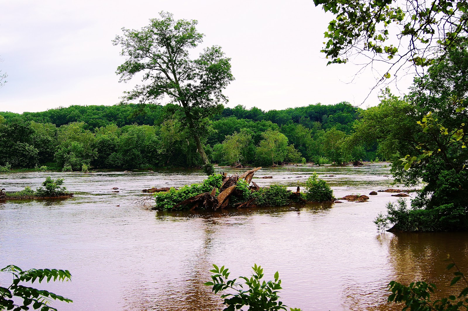
Morning on the Potomac.

As you move upstream past Little Falls and then Great Falls, the locks become less and less frequent because the elevation gain of the C&O Canal diminishes. With fewer locks, there are also fewer parking areas which is why Swain's lock is a good starting point for both an upstream walk and a downstream walk.

First the downstream walk. You can follow the towpath to roughly mile post 15.5 where you will find the start of the River Trail marked by a waist high concrete pylon. I wanted to follow this trail all the way to the end because I believe it takes you to C&O Canal visitor's center at mile post 13 but rain cut the walk short. I don't mind getting wet but my digital camera sure does.


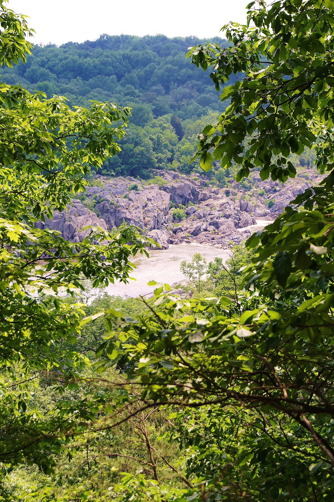
 Another overlook on one of the Potomac's channels.

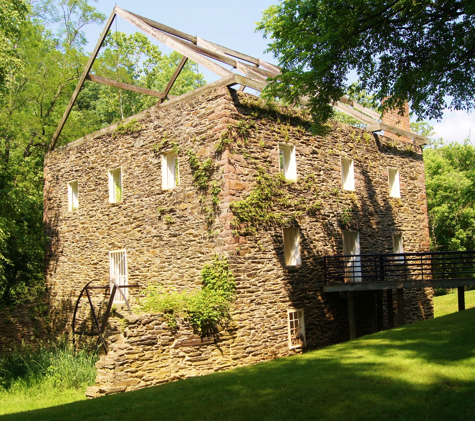
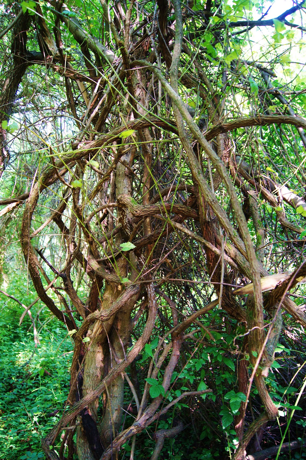
The best thing about this section of the canal is that it is the portion that most closely resembles what the canal probably looked like in the 1800s.

George Washington was an early proponent of the canal, whose name is an abbreviation for Chesapeake and Ohio Canal. He wanted to provide a link from the Eastern Seaboard to the Great Lakes region of the country. Work on the canal started in 1831 and originally the idea was to push it 350 miles inland. But with the advent of railroads, the canal only made it 185 miles to Cumberland Maryland before construction stopped for good. Still, according to the Potomac midpoint market, the canal's busiest year was 1871 when boats transported 850,000 tons of coal, grain and whiskey up and down stream.

I could have delivered this lecture to Loki, but, as always, he's pretty much only interested in the feth possibilities of the situation and you can't fetch history.

 Loki clears some river water from his ears.

Dying to do what he does best, he selected a massive tree branch on the shore of the Potomac and waited dutifully for me to chuck it in. I found him a smaller, more manageable because bigger isn't always better.


 At this point on the canal, there aren't that many people so as long as there are no geese for Loki to disturb, it's a good place for him to swim.

The canal much as it must have looked in 1850, if someone had a Border Collie back then.
                                                                                   
What the canal did look like in the 1900s

The canal pretty much shut down for business in 1924 and fell into ruin as a property of B&O Railroad company. The railroad sold it to the National Park Service in exchange for a loan in 1938 which strikes me as a pretty good deal. We didn't get much out of the banks in the last financial meltdown. Further downstream, finding water in the canal is pretty much hit or miss. Depends whether the latest breaches in the canal have been repaired.

Upstream, the walk is much the same up to mile post 18.5. At mile post 17.5 you reach the mid-point of the Potomac, or the half way marker between where it enters the Chesapeake and its mountain source in the Blue Ridge.

 
 Midpoint marker.
  The Lock House at Swain's lock 
So how did Swain's Lock get it's name since it is really Lock 21? Well, the Swain family lived in the Lock house from around 1900 to 2006 first as lock keepers before they switched over to a concession stand selling food, drinks and renting canoes you could paddle around on either on the river or the canal.

I'm not sure what happened in 2006. Some reports say the National Park service forced the family out because their concession stand competed with the one at mile post 13 at the main visitor center. The Swain family itself said they were moving on to other things but hoped to keep doing business with the Park Service. Either way, they are gone.


Canada Geese with Goslings on the Canal.


 Practical information: Take River Road towards Poolesville. Swain's Lock Road will be on your left just past Piney Meeting House Road. This is the first parking area upstream from the visitor's center at mile post 13. Swain's Lock is about mile post 16.5. At milepost 15.5 you can pick up the River Trail for a variation of a towpath walk. Heading upstream to mile post 18.5, it is a towpath walk.


Tuesday, May 29, 2012

Walk 10: Seneca Creek's Schaeffer Farm

Well, I didn't much care for the walk at the lake in  Seneca Creek State Park (see Walk 10), but the Schaeffer Farm section of the park more than makes up for it.

A carpet of ferns along the White Trail.

The Schaeffer Farm trails have no names other than a color and we picked the White Trail, a four mile loop that skirts around an abandoned farm. The other trails include, green, yellow, red and blue. All the trails link up one way or another so there are miles of variations involved.

We parked at the Black Rock Mill on Seneca creek and crossed the one-lane bridge to the foot of the bluffs on the other side. There are two ways up the bluff from here. The first is an informal trail that heads more of less straight up and your heart will be pounding when you reach the top.

Black Rock Mill ground wheat into flour for most of the 1800s. After that, wheat production in the country headed west and mill went bust.

The second is the Seneca Ridge Trail, marked with red blazes, that switch backs to the top. Either way, the short, sharp climb means most walkers pass up these woods, which is a mistake.


Once on top of the bluff, the White Trail loops around both abandoned and working farm fields with occasional sections out in the sun. With August temperatures already here in May, this was a one hot walk.


Black Rock Mill back around 1900.

We stopped at the one stream that cuts through the bluffs to give Loki a cool down which he much appreciated. 

While the trails are clearly marked, there is not much information about them available and we passed near a property called Button Farm. When we walked down the lane to it, I couldn't really tell if it was a working farm or an abandoned one and not wishing to trespass, we took a photo and left.


This is how the county looked before urbanization took up much of the farms.

For the first time on our walks, we also passed by a signature plant for the area which are the huge vines that strangle the hardwoods. These vines wouldn't look out of place in the Amazon and you can climb them if the branches they are attached to can bear the weight. The downside is if they can't, the branch comes straight down which can be a problem.


Tarzan would be proud of our vines.

While the trail keeps to the cooler woods, which was much appreciated, we did see an abandoned hay field that is slowly turning back into woods. Several smaller trees such as Sycamores are already colonizing the field. Actually, I've heard that aerial surveys show that is happening all  up and down the East Coast as the small family farms go out of business. The amount of forest cover we have is up sharply from what was left in 1900.


In another hundred years, this will all  be forest once again.

Just before we hit Seneca Creek, Loki decided he had had about as much of the heat as he was going to take and found what has to be the deepest mud wallow I've seen in a long time.


Up to his chest in ripe smelling swamp mud. The next stop for Loki was a dip in Seneca Creek to wash off.


Practical information: Take Darnestown road towards Frederick and turn right on Black Rock Road. You can park by Black Rock Mill or on the side of the road across the one lane bridge. Pick up Seneca Ridge trail and climb the bluff. The White Trail is about 4 miles and is hilly. After wet weather, expect mud. Trail rating is 3 out of 3 stars. Never crowded.

Sunday, May 27, 2012

Walk 9: Gold Mines, Overlook and Urban Trail Dogs

You have your guard dogs, tracking dogs, seeing eye dogs and all the others. And every single one of them started out as a recalcitrant puppy who couldn't stand the idea of being tied to a leash.

Kai makes it clear that I can go for a walk if I want, but he's going to set his rear end down right here.

In a few months, Kai will be joining Loki on the long walks but right now, I can't get him to go down the driveway. But this is pretty much par for the course so far. After all, Kai is only about 12 weeks old. But even if he doesn't realize it, his training is already underway. He knows his name and he usually comes when he's called. Part of this probably comes from watching Loki respond to commands but it's still going to be a bit of an effort to turn him into a real urban trail dog.  
 
Imagine you're in the woods and small herd of deer bolts from the underbrush thirty feet away and heads for the next county. If your dog takes off after them, you're going to have a lot of running to do get him back. Not to mention the fact the deer are probably going to cross some busy road with your dog in hot pursuit. Not good for dog, deer, or drivers.

Kai reacts calmly to the leash by going completely berserk.

Nope, a good urban trail dog ignores EVERYTHING except you. Kai has some of the basics down. He does focus on either Sarah or I and the getting him used to the leash will just be a matter of slowly, slowly building this up until the leash is not threatening any longer. He'll probably be ready for long walks in August or September.

Loki has all this down pat. His preferred technique is to race fifty yards ahead on our walks and then wait for us to catch up. In his mind, he's setting up a tennis ball throw or a stick toss. In my mind, he's completely focused on us which keeps him from becoming focused on causing trouble.

Doing the Border Collie crouch. A typical pose for a collie who's fixated on something.

Of course, once the dog has this down, then it's possible to have some fun.


Loki fetches a stick tossed into a hollow tree.

The temperatures are soaring right now and it feels a lot more like August than it does May which meant Sarah and I abandoned the C&O Canal and headed for the cooler woods. But we still wanted to end up by the river so we choose the fat bulge of land in the C&0 Canal National Park that encompasses Great Falls. If you like, you can drive in through the main entrance and get nicked for $10 or so, but we chose to park on the side of MacArthur Boulevard at Falls Road and walked in on the Goldmine Loop Trail.

Yes, there is a real gold mine on the spot, or was. The bluffs of the Potomac Gorge here are largely white quartz  and from 1900 to 1940, miners pounded the quartz into dust to extract about 1/2 ounce of gold per ton of rock. Doesn't sound very economical and it wasn't.

Loki stakes a mining claim at water tank of the old gold mine.

A few areas of the woods are fenced off around the old mining buildings. I doubt there are any old, open shafts left since most of the area appears to be criss-crossed with collapsed mine shafts.


The old entrance to one of the shafts. The mines seem to have been collapsed but I don't whether by accident or on purpose.

We walked the goldmine loop going in and then took the overlook trail. The main difference between the two is the goldmine loop cuts directly through the woods while the overlook takes you to the edge of the bluffs so that you can get a bird's eye view of great falls.


These woods are much more open than thick jungles we have along the creek beds and parts of the forest had almost a park like feel with carpets of grass.


The overlook onto one of the channels at Great Falls.


With our meanderings and having Loki chase sticks, we probably walked 2 miles before we reached the canal and with the temperature close to 90 degrees, Loki, as always cloaked in his long fur coat,  was beginning to get pretty hot.

A quick chance to sit in the canal for about ten minutes solved that problem.

This canal water feels great! Why don't you come in for a swim with me?

Border Collies will do anything to please you including overheating themselves to the point they can really injure themselves. Loki has a lot of ways to indicate he needs some rest including pulling on the leash when he sees still waters that he can lie down in. Other signals he gives when off-leash include heading for shade or just moving more slowly than usual. The big signal is that when his tongue looks about as thick and big as a T-bone steak. Then, it's really time to rest him.

                                                                                                       One of the channels at Great Falls


From the visitor center, we headed downstream for about 1/2 mile to path that leads to Great Falls. The path has a series of bridges that cross over different channels and Loki didn't like a single one of them. Too much thundering water all around and he's not particularly fond of heights either. He kept us moving at a good clip to get past all this.

Two panoramic shots of the main channel at Great Falls.

Back up at the visitors center, the tourist boat was about to leave for a quick jaunt along the C&O Canal. This is a canal boat with seats placed on top so it is sort of authentic and sort of not. But it looks like fun. We kept Loki close by when the mules were about 10 feet away, but he just ignored them which is what he is supposed to do.

Moving stuff was what the canal was all about for about ten years before the railroads killed it off.

By this time, we'd spent about an hour in the sun and Loki needed another cool down before we climbed the bluffs again.

Sarah and Angus let Loki cool off before the climb back up the bluffs.


Practical information. The Goldmine Loop is marked by the Park Service as 3.2 miles total. We added the overlook and also went to Great Falls so the walk was probably 4.5 miles in total. Some steep up and down sections, mostly dirt trails. No rock hopping. We parked on the side of MacArthur Boulevard at the junction with Falls Road. There are no signs indicating no parking right here.


Saturday, May 26, 2012

Walk 8: Towpath, The Holy Fathers, the Stoned Tree, and Great Blue Herons

Every so often, I come under the  the spell of  purple prose and start spouting off nonsense about how dogs walks are really "pilgrimages to nature." It's a load of bull.

Seminarians on their 50 mile pilgrimage to the basilica. 

Well, it's not bull to some people. This morning I met about 30 seminarians who were doing a 50 mile trek along the C&O Canal. I stopped to chat with one of the students and asked, "Where are you from?" After he replied Lincoln, I thought for a moment that only Lincoln I knew was Lincoln, Nebraska. After he confirmed we were both talking about the same Lincoln, I noted it was a lot more than 50 miles away from DC. He agreed and then fell silent.

Of course, I overlooked this bit and jumped to the next obvious question: "Where are you going?" He replied, "I don't know. It is a basilica. I've never been there." Indeed. The conversation was wonderfully vague but full of faith, and overall, he was a pleasant guy. He smiled a lot. No matter. Whichever basilica it was, they were a lot closer to it than when they started 50 miles ago because at that point on the towpath, we were a hop, skip and jump away from the Maryland-DC line although I don't know if Seminarians do that sort of thing.

Weekends are busy days on the towpath and the walk between miles 6.5 and 4.5 is busier than most. There's is a lot crammed into those two miles. At Lock 6, which is confusingly placed at mile post 5, there is a great alternative route called the Lock 6 Trail. This takes you down to a small channel of the Potomac with fast water and kayaking gates set up.

 Sports people, being what they are, decided that shooting rapids was just too easy. So they hang two poles in the white water and target shoot through them. The different colors of the poles tell the boater whether they must make a right turn, left turn, or go through backwards. Loki would have liked to have dived into the water here, but with the currents strong right up to the shore, the most he was willing to do was wade around in a few inches.

Kayakers at work making something easy more difficult.

Of course, the kayakers have to get to to this channel, so in addition to Holy Fathers trudging along, Loki and I passed several people lugging their boats on their shoulders. No points for comments about huge bananas on their backs.

A Kayaker heads to the Lock 6 Trail.

But this section of the Potomac is also, apparently, a very good fishing spot as well. So that contingent is on the move as well as the bikers and hikers and dog walkers.


This place can get sort of crowded, you know.


And naturally, it was inevitable that some one would pass by with a pair of Border Collies with the identical markings as Loki. I was rejoining the towpath from the Lock 6 Trail and called out "Hello." The owner and the dogs were well matched because they never missed a beat and kept right on running. Never interrupt a Border Collie on his work mission. Of for that matter, their owner.

Border Collies and their owner on a mission.


The best part of the walk comes about mile 4.5 where an unmarked concrete road leads down to the Little Falls run. A quarter of a mile from the towpath lies a concrete overlook of the falls and this is where you find all the fishermen, both bird and man. The banks of the Little Falls Chute is lined with men with fishing poles and Great Blue Herons. I'm not sure why this is one of the best spots on the river to catch fish, but they sure were pulling in the fish.
The Great Blue Heron waits by a small waterfall for its prey.

I glanced directly across the river and saw at least 6 Herons all clustered together. Every so often, one of them would take off and circle around before coming down to a new spot to hunt.


A circling Great Blue Heron.


While Loki wasn't willing to do more than wade in an inch or two of water on the feeder channel, he was having none of Little Falls. I walked along the rocks to the edge of the river but he hung back ten or fifteen feet as if to say the view from their was just fine with him.
All of which shows Loki has a fair amount of common sense and perhaps a bit more than some of the fishermen who wade out to some of the rocks. Every year, a few of the drown.   


Little Falls


But course, Loki was more than willing to go into the placid waters of the canal even if I wasn't going to let him off the leash. Instead, he had to watch in frustration as several large carp hovered tantalizingly close to snapping distance.

Well, I don't know for a fact Loki would try to catch one of the fish. Probably he'd just swim around in circles until I got the point and threw a tennis ball for him.


Loki sizes up the sizeable Carp.


What with the the Holy Fathers and all the others on the move this morning, it was a day for strange sights. But none was more strange than the stoned tree, I found. All along the banks of the Potomac, the rocks have perfectly round holes drilled into them. During floods, this divots fill with rocks and the rushing water swirls them around causing them to act like a drill bit if you have a several million years to wait.

The Stoned Tree 

One of these pot holes appears to have been sheared off near the top and a seed grew towards the sunlight in the hole in the rock. Well, as they say, it takes all types.


Practical information: Take the Cabin John entrance to the Clara Barton Parkway and head towards DC. Pass the parking lot for Lock 7 and use the immediate next parking lot on the right. The parking lot is, unfortunately, unmarked but it comes right after a pedestrian foot bridge. A path leads down to mile 6.5 on the towpath. Walk to mile 4.5 for the Little Falls overlook. Alternative trails are Lock 6 Trail. One way is 2 miles. Path is flat, crushed gravel. Alternative path is plain old dirt, no maintenance.

Friday, May 25, 2012

To Make Things Easier....

I've started linking the posts that deal with long walks that broken up in sections such as the C&O Canal and Cabin John Creek. At the bottom of the posts, you can hit the label button to call up all the related walks.

Walk 7: Lock 10 and The Feds

There are a lot of ways to know that it is not going to be a good day and opening the front door only to find an FBI agent waiting for you is just one. Or for that matter, a U.S. Marshal or anyone from the IRS.

The fully restored lock house at Lock 10 on the Canal.

As Sarah and I parked at Lock 10 on the C&O Canal, I explained this to Loki. I felt I had to do something since he was going to have to be leashed for our entire walk this morning. While it is true that Montgomery County has a leash law that covers the entire county, this issue is honored in the breach more often than not. However, I have heard too many stories of National Park Rangers handing out $50 tickets to dog owners to risk letting Loki run free along the canal.

I told him that unless he was on a leash, the Park Rangers would "git him" and they'd probably use a long pole with a loop on the end. He'd be dragged off and tossed in the back of a truck with a lot of other vaguely criminal dogs and spend the night in the "pen." Loki didn't understand a word of it, of course, and just cocked his head like he does whenever I tell him a bunch of nonsense.

The Feds are gonna git ya, Loki! (yes, by the way, Loki has one blue and one brown eye which shows up nicely here)

Just to be confusing, Lock 10 is located roughly at milepost 9 on the canal, and on this walk, since it is a flat, easy path, we headed to milepost 7. I hoped the length of the walk would make up somewhat for the confining nature of the leash.

On this stretch of the towpath, there aren't really any good alternative trails since the canal is quite close to the river. As always, there are deer trails through the woods by the canal, but no improved trails. However, this two mile stretch of towpath does have three lock house where back in the day, lock keepers used to live.

The arrangement back when the canal was a 185 mile link to Cumberland, Maryland, was that a lock keeper had use of the house and small plot of level cleared land for a garden in addition to a modest salary. In exchange, canal boaters expected him to be on call 24 hours a day all year long to open and shut the lock gates. However, since the locks are fairly easy to use, I could well imagine a lock keeper leaning out a window and shouting down, "Just do it yourself! I'm busy!"

The Lock 8 lock house.

The Park Service does allow people to stay overnight in some of the lock houses that have been restored which sounds like an interesting idea.I would have brought it up with Loki but he would have just cocked his head to the side waiting for words he recognized like "walk," "biscuit," or "cat." I tell him "cat" when our three overweight cats have, in my opinion, been lounging around too much and Loki sets off to herd them in any direction except the one the cat wants to go in. This usually brings Sarah into the picture who tells Loki to leave the cats alone. We both slink off at that point grinning. Herding cats is just too much fun to pass up.

The third lock house on the walk.

We did take one of several detours to the banks of the Potomac and with all the rain we've been having, the river is running high and fast. 


The Potomac starts to flood some of the lower lying islands in the channels.

The interesting thing about the Potomac is you can tell if it is flooding with one glance. When the river turns brown from it's usual slate-gray color, it's in flood. The recent day-after-day rains we've have have washed a lot of silt into it.

Of course, floods don't really affect the canal unless they are so big the Potomac rises high enough to engulf the canal which does happen every so often. On the other hand, idle water in a warm place makes a great place for algae.


The green waters of the canal.

So on one side, we had the fast flowing, brown Potomac and on the other, the stagnate green waters of the canal.


Duck in the mud again. Not all of the canal is green. Where the locks are no longer functioning, the bottom is just marsh mud.


Overall, this is nice two mile walk one way, but the lower end of between mile posts 8 and 7 can't really be called a nature walk. When the engineers put in the Clara Barton Parkway, they snugged up against the canal along this stretch and as a result, there is a fair amount of traffic noise. But, like all the canal walks in Spring time, it is still scenic.

Practical information. Heading towards DC on the Clara Barton Parkway, pass the Carderock exit and park at parking lot on Lock 10. This is very close to mile post 9. Walk to mile post 7 and return. One way, the walk is 2 miles. The trail is crushed gravel and flat. As everywhere on the towpath, National Park Rangers enforce the leash law.

Thursday, May 24, 2012

Walk 6: Rock Creek and The Trail That Never Was

Whenever I think of Rock Creek, I'm reminded of Rudyard Kipling's description of the "great, green, greasy Limpopo River" that is "lined with fever trees on either side." Certainly parts of the forest in Rock Creek Park can resemble a bit of a jungle, and by August, the heat will be right up there to rival anything the tropics can throw at you.

The Great Green Greasy Rock Creek.

With all the recent rain, Sarah and I had no intention of walking one of Rock Creek's dirt paths with Loki but we wound up on one this morning for the same reason a lot of people wind up where they don't want to be: they got handed a bum map.

As I peered out this morning at the newly cleared sky, I figured this would be an excellent time to find a new trail with firm footing. After looking up the website for Montgomery County parks, I zeroed in on a trail that paralleled Kensington Parkway from Beech Drive up to Frederick Avenue. The trail showed a lot of promise. One way, it might just stretch out to 1.5 miles and if you started at Beech, you would up in Clum-Kennedy Garden.

The Dogwoods of Clum-Kennedy Garden.

Sarah and I decided to do the walk from the top down so to speak and everything looked bright as we strolled through the garden. Of course, Loki, who was straining at the leash with his tail between his legs, wasn't having such a good time. He wanted to fetch a tennis. As we reached the end of the garden, we looked for the trail that had stood out so plainly on the county website and then looked at the wide shoulder of the parkway. No trail. We hunted for it for two block with Loki pulling every step of the way and gave up. There ain't no trail here folks.

But we were close to a familiar Rock Creek walk and headed that way. Going toward DC on Beech Drive, we crossed under 495 and then over Rock Creek before pulling off on gravel lot just before Levelle Drive. The entrance to the trail is across the steel foot bridge which is currently about 12 above the creek level which was running high because all our recent rain. Hard to imagine, but sometimes Rock Creek crests a few feet above the highest rail of the bridge.

We let Loki loose and he tore off to position himself for a ball toss. He ran and fetched as we made our way up the asphalt tail to the concrete path which is really on old abandoned road. Here we went right and at the next fork, we headed down a dirt path that follows the banks of Rock Creek.

If you're the sort of person who is nervous about walking alone in secluded places, this may not be a great trail for you. But if you want to see a bit of nature without having to drive all the way the Potomac, this will fill the bill.

The Creek Bank Path


Since it was still early in the morning and the sun hadn't had a chance to burn off the mist, we caught some wonderful views of a gentle fog rolling through the woods. Actually, everything about the walk was about water. To one side the creek flowed, underfoot the mud squelched, and raindrops clung to the leaves of the plants.

Morning fog in our East Coast hardwood forests.


Brush the plants on the side of the trail and you may as well have taken a shower.


As we proceeded, the trail seemed to get wetter and wetter until it more or less disappeared into vast pools of water. It was about this point that I recalled that my daughter has spent the last three or four weeks learning about how to conserve water.


Now, I'm all for teaching kids about the need for conservation in general and how it's a good idea to recycle, but I'm pretty stumped when folks spend a lot of time on water in Montgomery County. Yes, it will be dry in the county come August. Every year it is, but in September, the chances are we will get hit with the remnants of two and probably more hurricanes. That's when Rock Creek will be over the tops of the bridges and if the creek is really rolling, it will uproot a few of them.

Of course, Loki wasn't concerned about any of this. He just wanted to find places he could dive into the creek and swim after a tennis ball. Time after time, he raced down the embankment but if he saw a strong current, he turned around and ran to a new spot. He likes swimming but, if he could talk, he'd probably say, "I don't do rapids."

After about 1.5 miles, we recrossed Rock Creek and picked up the asphalt hiker-biker trail that runs through the park. We stopped and chatted with another pair of dog walkers with a puppy and then followed the trail through what most of Washington DC was originally built on: a swamp.

Swamp land was here before all the roads and houses.

A funny place to worry about water other than how to handle it.

Practical information: Heading away from the DC line, pass the junction of Levelle Drive and Beech Drive. Take your first right hand turn off onto a gravel parking area. An asphalt trail leads to  a bridge over Rock Creek. Follow that trail to T junction with a concrete path which is really an abandoned road. Head right here and then veer off the concrete onto a dirt that parallels the creek. The park system doesn't maintain the trail but there is a foot bridge over a tributary into Rock Creek on the way. The dirt path ends at a second bridge over Rock Creek. Cross that and keep right back towards the parking lot. One way about 1.25 miles.