Showing posts with label canal. Show all posts

Wednesday, June 13, 2012

Walk 21: Seneca Aqueduct, Washington Slept Here, and Stuart's Great Blunder

Whew! When you hit the Seneca Aqueduct at Riley's Lock on the C&O Canal, get ready for an avalanche of history.

What's left of the Seneca Aqueduct after the September 1971 blew out one of its arches.

To start with, this is the site of the Seneca Quarry which produced much of the sandstone used in the construction of the lower reaches of the C&O Canal. But even before this, quarry work went back to the Revolutionary War period and the cut stone was floated down the Potomac to Great Falls before being shunted onto the Seneca Canal, a forerunner of the C&O, as a bypass to the rapids. George Washington was a frequent overnight visitor to the quarry so you can say "Washington Slept Here."

What the Aqueduct looked like before the 1971 flood.

The stone aqueduct carried the C&O canal over Seneca creek where the now broad and deep creek flows into the Potomac and was maintained by the Riley family for long enough the lock here is named after them.

But more importantly, this is a spot where the Potomac is both broad and shallow, a great place if you wanted to ford it with a wagon.

Which is exactly what Confederate cavalry general J.E.B. Stuart did on June 24th, 1863. Two days earlier, Stuart had been staging a review of his troops at Brandy Station, Virginia, for the local ladies when a Union cavalry force joined the festivities. Stuart's men drove the Union forces back across the river in the largest cavalry battle of the war, but Stuart didn't take kindly to the audacity of the Union gatecrashers.

He requested permission from Confederate commander Robert E. Lee for a retaliatory road into Maryland just as Lee started moving his army across the Potomac. Admonished that the cavalry's main job was to act his "eyes and ears," Lee turned Stuart loose. It was the last time Lee would hear from Stuart before Lee ran head on into the Union Army at a small Pennsylvania town called Gettysburg. No one thing determines the course of a battle, especially not a three day slaughter like Gettysburg, but Lee did go into the battle with little knowledge or where his enemy was. The Union army won the battle and Lee lost his one last big chance to end the war.

Where the heck was Stuart during this time? Well a lot of places because he rode completely around the Union army before rejoining Lee's retreat into Virginia, but after crossing the Potomac at Rowser's Ford, he wasted time wrecking the canal and then marched on Rockville, the county seat of Montgomery County.

J.E.B. Stuart left Lee blind when it counted. The rest, as they say, is history.

Once in Rockville, Stuart captured 125 Union supply wagons and then tried to drive the booty back to Lee. Slowed down by the wagons, he never caught up.

You could probably pick a lot of places where the South lost the Civil War. Rowser's Ford at Riley's lock won't be at the top of the list but it's certainly on the list.

Once you cross the Aqueuct, Loki and I took the first right off the towpath, a dirt road. This leads to the ruins of the Seneca Stonecutting Mill. Powered by water from the canal which was then diverted into Seneca Creek, this mill cut the stone quarried at Seneca Quarry.

What's left of the Seneca Stonecutting Mill.

Stone from this mill wound up building a number of buildings in Washington DC but the most famous is the original Smithsonian Museum, what's colloquially known as the Castle of the Mall.


The Castle


I couldn't find any historic photos of the stonecutting mill but the Library of Congress has these elevation drawings.

Under water power, the mill featured to eight foot band saws that could cut the rock at a rate on one inch per hour. Later, the mill upgraded to a turbine for electricity.

From the ruins of the mill, follow the road up to River Road, a 1 mile walk, that follows Seneca Creek. This is mile one of the Seneca Greenway Trail and if walking on a road sounds a bit unexciting, it is a gravel road and scenic which makes up for it.

 The mile walk to River Road.

When you reach River Road, you will see right across fromn you Poole's General Store. Opened in the mid-1800s, this General Store is the oldest, continuing operating General Store in the County.


Poole's General Store was operated by the AllNutt family for over a hundred years before Poole took it over. 

I wouldn't let this photo fool you too much. The county, with it's million residents, shops pretty much at Target and what not.


 Riley's Lock also serves a base for the Calleva outdoor education camp and here a small campers are being paddled out under the Aqueduct to the broad reaches of the Potomac. The campers were singing so it sounded like they were having a good time.


Other more recent history comes in the form a request by the National Park that fishermen do them a favor by killing any Northern Snakes heads they catch in the canal.


These voracious fish, which are native of China,  were released into a Maryland lake a few years ago. Not only are they eating virtually every other fish in our waterways, but they are spreading because of their ability to walk short distances on land. Maryland, which abolished the death penalty, makes an exception for these fish.


Maybe all the Snakeheads being killed in the area is what is keeping this Black Vulture hanging around.


Tuesday, June 5, 2012

Walk 16: Pennyfield Lock and Who Slept Here?

We've all seen them: signs over some historic looking inn with the words "Washington (or whoever) slept here." And this is Pennyfield Lock's claim to fame on the C&O Canal.

The Lock House at Pennyfield Lock.

Like Swain's Lock just downstream, Pennyfield Lock got it's name from a family that lived here for a great number of years. In addition to the running the lock, they also ran an inn across the way that was called, well, the Pennyfield Inn.


                                                  Here's a shot of the inn in 1910.                                

There's a couple of interesting things about this shot other than the old car in front of the inn. If you look closely, you can see there are virtually no trees other than a handful of scraggly ones around the inn. Now a days, this area is so densely forested it's a bit difficult to get through it all without a deer path at least to follow. I'm not sure what they used the trees for, but a lot of the area was clear cut around 1900 in massive charcoal producing operations, something I'm thankful are long past.

But so far, I haven't said who was the famous person who used to sleep at the Pennyfield Inn, have I? Well, brace yourself for it and this is earth shattering but it was Grover Cleveland. Yes, that's right Grover Cleveland. It's not much I know, but Grover Cleveland was the only president to serve two non-consecutive terms. He was elected in 1884 and then was defeated in 1888 only to bounce back in 1892. As luck would have it, the economy crashed in 1893 and that pretty much wrapped up his political career. Even kind hearted historians have trouble making old Grover interesting. One historian said he was honest and had common sense. Imagine that.

Well, one thing is for certain. He spent a fair amount of his presidential time bass fishing on the canal when he wasn't building an election history that would stump trivia players for decades.

Loki was not impressed by the discovery that Cleveland slept at Pennyfield Lock. The dog has common sense.

Once at the lock, you have the choice of upstream or down because there aren't any side trails to the towpath. Loki and I went two miles downstream and got a good look at a section of the canal that had been blasted out of the bluffs.


Rock wall after blasting to make way for the canal


But we also spotted someone else who sleeps at Pennyfield Lock and sadly this was a homeless person.

The woods between the canal and the Potomac in certain areas of the canal do have places where homeless people sleep. Sometimes when I've been following game trails through the woods, I've stumbled on the sites. They sure aren't hard to miss thanks to all the trash, plastic bottles and other garbage.

The Pennyfield Inn in 2009 when the National Park Service had to tear it down because it had become a safety risk.

Over the last 100 years, we lost our historic inn at Lock 22 but we regained all the forests that had been chopped down. We remember Lock 22 because an obscure president who used to take a break there. No one remembers the Panic of 1893 because we're still reeling from the panic of 2008.

Not that Loki cares. He just wants to cool off in the canal water and fetch a tennis ball.

 What the Park Service needed was a whole lot of these Grover Cleveland $1000 bills. Echoing his presidency, these were issued twice, once in 1928 and once in 1934.


Practical information: Drive out River Road towards Poolesville. Pennyfield Lock road will be on your left, parking lot at the end of the road. Towpath walks either upstream or downstream. I don't know of any variation walks in the area.

Sunday, June 3, 2012

Swain's Lock Revisted and Los Federales

Checking out a map, I noticed that a trail is marked on the inland side of Swain's Lock so I went back to see if I could find these routes. As you head into the parking lot, a wooden foot bridge on the left hand side would be the obvious starting point heading upstream.

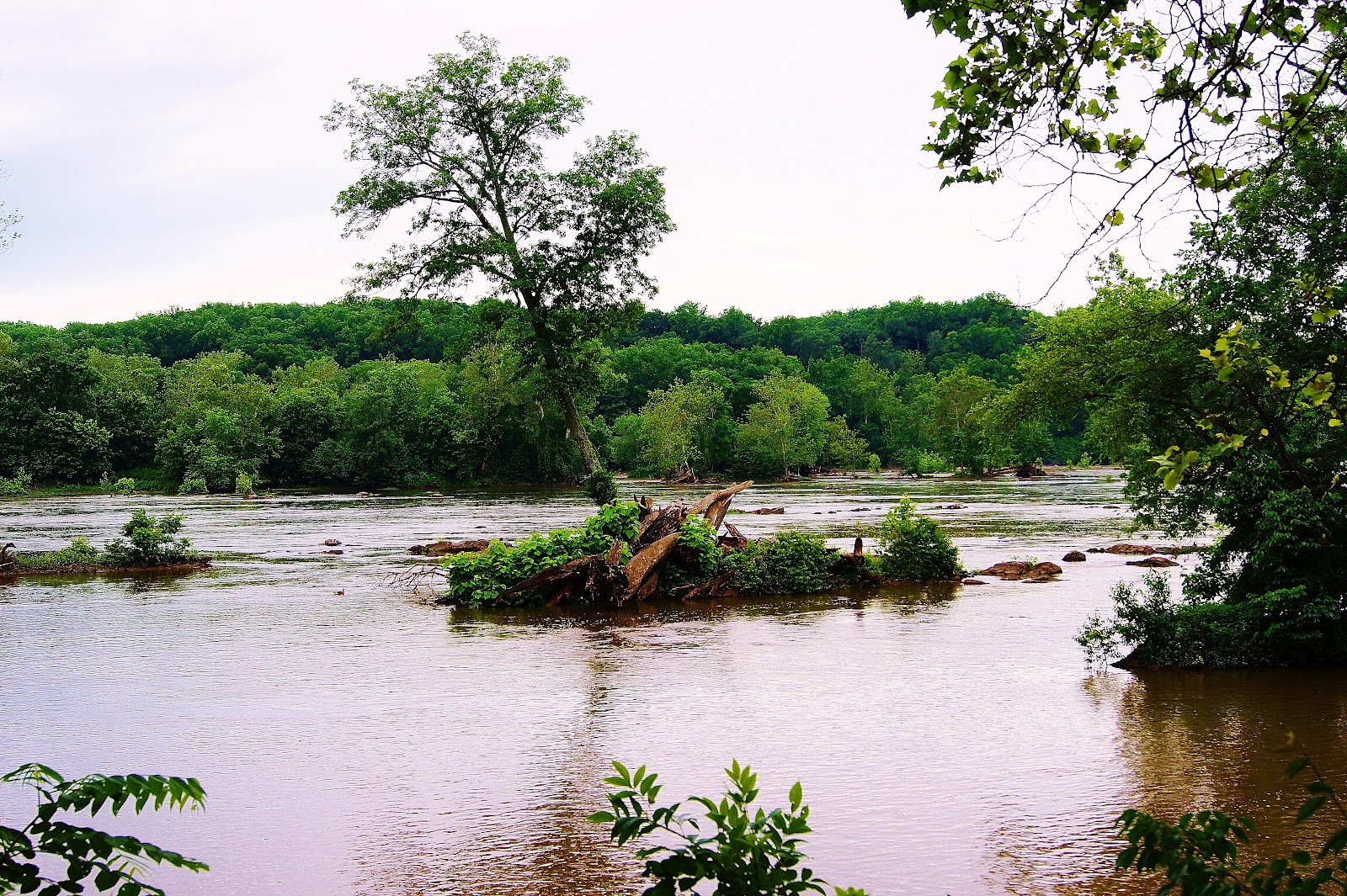
The Potomac is running high and is a just a couple of shades lighter than the color of milk chocolate.

Unfortunately, this trail led up a steep bluff and dead ended in the yards of two private residences. Searching the downstream side of the parking lot turned up nothing. However, I'm pretty sure you can pick up the Fordham Mine Trail from the C&C Canal visitor's center. Too bad it will be a straight up and back trail. Never trust a map when you can find out about a trail on foot.

Here is the same shot four days earlier with flat gray light from an overcast sky.

While walking the canal again in this section, I spent some time tossing the tennis ball into the water until Loki started to tire out. I switched him back onto his leash so he could catch his breath while walking and a good thing too. Just a minute later, some Park Rangers came around the corner in their SUV. Unthinkingly as I passed them, I wave to the officers with my plastic throwing stick complete with tennis ball in it. Of course, Loki was still sopping wet so it was pretty obvious he'd been off leash. I didn't realize it until a bit later that the Park Rangers may have been less than pleased with my gesture.

Los Federales. Good luck and tired dog saved me from a $50 ticket.


Wild flowers on the edge of the canal.

Thursday, May 31, 2012

Walks 11-12: Swains Lock and the Potomac Midpoint

I'm going to add two walks under a single entry because they both start from the same point which is Swain's Lock at roughly milepost 16.5 on the canal.

Morning on the Potomac.

As you move upstream past Little Falls and then Great Falls, the locks become less and less frequent because the elevation gain of the C&O Canal diminishes. With fewer locks, there are also fewer parking areas which is why Swain's lock is a good starting point for both an upstream walk and a downstream walk.

First the downstream walk. You can follow the towpath to roughly mile post 15.5 where you will find the start of the River Trail marked by a waist high concrete pylon. I wanted to follow this trail all the way to the end because I believe it takes you to C&O Canal visitor's center at mile post 13 but rain cut the walk short. I don't mind getting wet but my digital camera sure does.


 Another overlook on one of the Potomac's channels.

The best thing about this section of the canal is that it is the portion that most closely resembles what the canal probably looked like in the 1800s.

George Washington was an early proponent of the canal, whose name is an abbreviation for Chesapeake and Ohio Canal. He wanted to provide a link from the Eastern Seaboard to the Great Lakes region of the country. Work on the canal started in 1831 and originally the idea was to push it 350 miles inland. But with the advent of railroads, the canal only made it 185 miles to Cumberland Maryland before construction stopped for good. Still, according to the Potomac midpoint market, the canal's busiest year was 1871 when boats transported 850,000 tons of coal, grain and whiskey up and down stream.

I could have delivered this lecture to Loki, but, as always, he's pretty much only interested in the feth possibilities of the situation and you can't fetch history.

 Loki clears some river water from his ears.

Dying to do what he does best, he selected a massive tree branch on the shore of the Potomac and waited dutifully for me to chuck it in. I found him a smaller, more manageable because bigger isn't always better.


 At this point on the canal, there aren't that many people so as long as there are no geese for Loki to disturb, it's a good place for him to swim.

The canal much as it must have looked in 1850, if someone had a Border Collie back then.
                                                                                   
What the canal did look like in the 1900s

The canal pretty much shut down for business in 1924 and fell into ruin as a property of B&O Railroad company. The railroad sold it to the National Park Service in exchange for a loan in 1938 which strikes me as a pretty good deal. We didn't get much out of the banks in the last financial meltdown. Further downstream, finding water in the canal is pretty much hit or miss. Depends whether the latest breaches in the canal have been repaired.

Upstream, the walk is much the same up to mile post 18.5. At mile post 17.5 you reach the mid-point of the Potomac, or the half way marker between where it enters the Chesapeake and its mountain source in the Blue Ridge.

 
 Midpoint marker.
  The Lock House at Swain's lock 
So how did Swain's Lock get it's name since it is really Lock 21? Well, the Swain family lived in the Lock house from around 1900 to 2006 first as lock keepers before they switched over to a concession stand selling food, drinks and renting canoes you could paddle around on either on the river or the canal.

I'm not sure what happened in 2006. Some reports say the National Park service forced the family out because their concession stand competed with the one at mile post 13 at the main visitor center. The Swain family itself said they were moving on to other things but hoped to keep doing business with the Park Service. Either way, they are gone.


Canada Geese with Goslings on the Canal.


 Practical information: Take River Road towards Poolesville. Swain's Lock Road will be on your left just past Piney Meeting House Road. This is the first parking area upstream from the visitor's center at mile post 13. Swain's Lock is about mile post 16.5. At milepost 15.5 you can pick up the River Trail for a variation of a towpath walk. Heading upstream to mile post 18.5, it is a towpath walk.


Saturday, May 26, 2012

Walk 8: Towpath, The Holy Fathers, the Stoned Tree, and Great Blue Herons

Every so often, I come under the  the spell of  purple prose and start spouting off nonsense about how dogs walks are really "pilgrimages to nature." It's a load of bull.

Seminarians on their 50 mile pilgrimage to the basilica. 

Well, it's not bull to some people. This morning I met about 30 seminarians who were doing a 50 mile trek along the C&O Canal. I stopped to chat with one of the students and asked, "Where are you from?" After he replied Lincoln, I thought for a moment that only Lincoln I knew was Lincoln, Nebraska. After he confirmed we were both talking about the same Lincoln, I noted it was a lot more than 50 miles away from DC. He agreed and then fell silent.

Of course, I overlooked this bit and jumped to the next obvious question: "Where are you going?" He replied, "I don't know. It is a basilica. I've never been there." Indeed. The conversation was wonderfully vague but full of faith, and overall, he was a pleasant guy. He smiled a lot. No matter. Whichever basilica it was, they were a lot closer to it than when they started 50 miles ago because at that point on the towpath, we were a hop, skip and jump away from the Maryland-DC line although I don't know if Seminarians do that sort of thing.

Weekends are busy days on the towpath and the walk between miles 6.5 and 4.5 is busier than most. There's is a lot crammed into those two miles. At Lock 6, which is confusingly placed at mile post 5, there is a great alternative route called the Lock 6 Trail. This takes you down to a small channel of the Potomac with fast water and kayaking gates set up.

 Sports people, being what they are, decided that shooting rapids was just too easy. So they hang two poles in the white water and target shoot through them. The different colors of the poles tell the boater whether they must make a right turn, left turn, or go through backwards. Loki would have liked to have dived into the water here, but with the currents strong right up to the shore, the most he was willing to do was wade around in a few inches.

Kayakers at work making something easy more difficult.

Of course, the kayakers have to get to to this channel, so in addition to Holy Fathers trudging along, Loki and I passed several people lugging their boats on their shoulders. No points for comments about huge bananas on their backs.

A Kayaker heads to the Lock 6 Trail.

But this section of the Potomac is also, apparently, a very good fishing spot as well. So that contingent is on the move as well as the bikers and hikers and dog walkers.


This place can get sort of crowded, you know.


And naturally, it was inevitable that some one would pass by with a pair of Border Collies with the identical markings as Loki. I was rejoining the towpath from the Lock 6 Trail and called out "Hello." The owner and the dogs were well matched because they never missed a beat and kept right on running. Never interrupt a Border Collie on his work mission. Of for that matter, their owner.

Border Collies and their owner on a mission.


The best part of the walk comes about mile 4.5 where an unmarked concrete road leads down to the Little Falls run. A quarter of a mile from the towpath lies a concrete overlook of the falls and this is where you find all the fishermen, both bird and man. The banks of the Little Falls Chute is lined with men with fishing poles and Great Blue Herons. I'm not sure why this is one of the best spots on the river to catch fish, but they sure were pulling in the fish.
The Great Blue Heron waits by a small waterfall for its prey.

I glanced directly across the river and saw at least 6 Herons all clustered together. Every so often, one of them would take off and circle around before coming down to a new spot to hunt.


A circling Great Blue Heron.


While Loki wasn't willing to do more than wade in an inch or two of water on the feeder channel, he was having none of Little Falls. I walked along the rocks to the edge of the river but he hung back ten or fifteen feet as if to say the view from their was just fine with him.
All of which shows Loki has a fair amount of common sense and perhaps a bit more than some of the fishermen who wade out to some of the rocks. Every year, a few of the drown.   


Little Falls


But course, Loki was more than willing to go into the placid waters of the canal even if I wasn't going to let him off the leash. Instead, he had to watch in frustration as several large carp hovered tantalizingly close to snapping distance.

Well, I don't know for a fact Loki would try to catch one of the fish. Probably he'd just swim around in circles until I got the point and threw a tennis ball for him.


Loki sizes up the sizeable Carp.


What with the the Holy Fathers and all the others on the move this morning, it was a day for strange sights. But none was more strange than the stoned tree, I found. All along the banks of the Potomac, the rocks have perfectly round holes drilled into them. During floods, this divots fill with rocks and the rushing water swirls them around causing them to act like a drill bit if you have a several million years to wait.

The Stoned Tree 

One of these pot holes appears to have been sheared off near the top and a seed grew towards the sunlight in the hole in the rock. Well, as they say, it takes all types.


Practical information: Take the Cabin John entrance to the Clara Barton Parkway and head towards DC. Pass the parking lot for Lock 7 and use the immediate next parking lot on the right. The parking lot is, unfortunately, unmarked but it comes right after a pedestrian foot bridge. A path leads down to mile 6.5 on the towpath. Walk to mile 4.5 for the Little Falls overlook. Alternative trails are Lock 6 Trail. One way is 2 miles. Path is flat, crushed gravel. Alternative path is plain old dirt, no maintenance.

Friday, May 25, 2012

Walk 7: Lock 10 and The Feds

There are a lot of ways to know that it is not going to be a good day and opening the front door only to find an FBI agent waiting for you is just one. Or for that matter, a U.S. Marshal or anyone from the IRS.

The fully restored lock house at Lock 10 on the Canal.

As Sarah and I parked at Lock 10 on the C&O Canal, I explained this to Loki. I felt I had to do something since he was going to have to be leashed for our entire walk this morning. While it is true that Montgomery County has a leash law that covers the entire county, this issue is honored in the breach more often than not. However, I have heard too many stories of National Park Rangers handing out $50 tickets to dog owners to risk letting Loki run free along the canal.

I told him that unless he was on a leash, the Park Rangers would "git him" and they'd probably use a long pole with a loop on the end. He'd be dragged off and tossed in the back of a truck with a lot of other vaguely criminal dogs and spend the night in the "pen." Loki didn't understand a word of it, of course, and just cocked his head like he does whenever I tell him a bunch of nonsense.

The Feds are gonna git ya, Loki! (yes, by the way, Loki has one blue and one brown eye which shows up nicely here)

Just to be confusing, Lock 10 is located roughly at milepost 9 on the canal, and on this walk, since it is a flat, easy path, we headed to milepost 7. I hoped the length of the walk would make up somewhat for the confining nature of the leash.

On this stretch of the towpath, there aren't really any good alternative trails since the canal is quite close to the river. As always, there are deer trails through the woods by the canal, but no improved trails. However, this two mile stretch of towpath does have three lock house where back in the day, lock keepers used to live.

The arrangement back when the canal was a 185 mile link to Cumberland, Maryland, was that a lock keeper had use of the house and small plot of level cleared land for a garden in addition to a modest salary. In exchange, canal boaters expected him to be on call 24 hours a day all year long to open and shut the lock gates. However, since the locks are fairly easy to use, I could well imagine a lock keeper leaning out a window and shouting down, "Just do it yourself! I'm busy!"

The Lock 8 lock house.

The Park Service does allow people to stay overnight in some of the lock houses that have been restored which sounds like an interesting idea.I would have brought it up with Loki but he would have just cocked his head to the side waiting for words he recognized like "walk," "biscuit," or "cat." I tell him "cat" when our three overweight cats have, in my opinion, been lounging around too much and Loki sets off to herd them in any direction except the one the cat wants to go in. This usually brings Sarah into the picture who tells Loki to leave the cats alone. We both slink off at that point grinning. Herding cats is just too much fun to pass up.

The third lock house on the walk.

We did take one of several detours to the banks of the Potomac and with all the rain we've been having, the river is running high and fast. 


The Potomac starts to flood some of the lower lying islands in the channels.

The interesting thing about the Potomac is you can tell if it is flooding with one glance. When the river turns brown from it's usual slate-gray color, it's in flood. The recent day-after-day rains we've have have washed a lot of silt into it.

Of course, floods don't really affect the canal unless they are so big the Potomac rises high enough to engulf the canal which does happen every so often. On the other hand, idle water in a warm place makes a great place for algae.


The green waters of the canal.

So on one side, we had the fast flowing, brown Potomac and on the other, the stagnate green waters of the canal.


Duck in the mud again. Not all of the canal is green. Where the locks are no longer functioning, the bottom is just marsh mud.


Overall, this is nice two mile walk one way, but the lower end of between mile posts 8 and 7 can't really be called a nature walk. When the engineers put in the Clara Barton Parkway, they snugged up against the canal along this stretch and as a result, there is a fair amount of traffic noise. But, like all the canal walks in Spring time, it is still scenic.

Practical information. Heading towards DC on the Clara Barton Parkway, pass the Carderock exit and park at parking lot on Lock 10. This is very close to mile post 9. Walk to mile post 7 and return. One way, the walk is 2 miles. The trail is crushed gravel and flat. As everywhere on the towpath, National Park Rangers enforce the leash law.

Friday, May 18, 2012

Walk Two: Towpath Miles 10-11 With Billy Goat Trail

Dog walking. Sounds simple, eh? But like everything else, put in enough endeavor, and it can become relatively complicated. Which is why I got up at 5:45 a.m. with one thought in mind: uncover the Potomac mists.

Of course, Loki and Kai heartily approve of getting up early. And why not? They spend a lot of the day catnapping (or should that be dognapping) anyway So about five minutes after rolling out of bed, I was rolling the basement slider open and Loki and Kai shot off into the backyard to do, well, what dogs do first thing in the morning. They frolicked and chased each other about while I got my cup of coffee and about fifteen minutes later, Loki and I were headed back the Carderock parking lot to do the C&O Towpath walk from mile posts 10 to 11.


This is a great walk because it's not the usual up and back on the flat towpath. Instead, at the last parking lot you can pick up the Eastern Section of the Billy Goat Trail. Most walking Washingtonians
have heard of the Billy Goat Trail which is rocky, hilly trek along the Potomac Gorge. The problem for dog walkers is the Western Section has a scramble up a rock face. Definitely not a dog thing since they lack the oppose thumbs you need when you panic about fifty feet up and grab the rock like it's the last thing you will touch before you die. But the Eastern Section is just up and down with the hills, no rock scrambles.

 So with the sun just barely up, Loki headed down the trail, occasionally looking back to check if I had picked up the pace yet or was still doing my usual turtle interpretation. Loki knows that around each and every corner of a trail, there is the possibility that a Grizzly Bear may be lurking in the weeds. It's his job to check this out which is why he sprints fifty yards ahead, looks around, and then waits. He's also checking to see if there are any creeks which I might chuck a tennis ball into. Finally, he needs to sniff a lot of things as he goes. Borders Collies are multi-taskers even if most of the tasks are fairly useless.
                                What's taking you so long?                                                                               

As for myself, I'm doing fairly useless things also like hunting down Mountain Laurel which is in bloom right now. The gorge, for some reason, doesn't have a lot of laurel and seems devoid of wild rhododendron. I'm not sure why because if you head west to Catoctin Mountain and further into Western Maryland, the woods are overloaded with the stuff. 

 From the top of the Carderock cliffs, I catch my first glimpse of the river and smile. It's now about 6:30 a.m. and the mists are risings nicely off the water. I don't know whether it is because the river is warm or the Spring morning is nippy, but it's one or the other.


Mountain Laurel in bloom


First glimpse of the river mists.

After the cliffs, the trail heads down at a reasonable angle to the river which just adds to Loki's excitement. He is a thorough water dog even though his forebearers hail landlocked areas of the British Isles. He is also a chicken of astonishing proportions which doesn't bother me in the slightest. What one person might call a somewhat cowardly disposition, another would say is a strong survival instinct. Which is why it doesn't bother me when Loki wades about along the shoreline of the river.

Loki never passes up a swim.

After a couple of days of heavy rains, the Potomac is running high and fast. If he went out about 10 feet, the current might grab him and the next stop would be about 10 miles downstream in Georgetown. If you have an adventuresome dog, you might want to keep him on a leash even in the water.
But each to his own. I'm not in the mood for a swim and while he is wandering in the shallows, I have a chance to look for something to use my camera on.

A small waterfall on a creek leading to the river.


Spring flowers.

I know this flower. I even have a domesticate version in my garden, but for the life of me can't remember it's name.


But while I'm wasting time, Loki shows me he has better things to do. For a Border, most everything is work in one way or another. When we reach a flooded out section of the trail, Loki knows the Park Rangers are going to need a hand with this so he pitches in with some creek clearance efforts.
Why leave big sticks in the creek for the Park Rangers to worry about? I'll just drag the thing out myself.


This is fine as far as it goes, but the Potomac in the gorge is a wild and wooly river. Upstream, its fat like a bloated snake but then all that water has to get shoved down this narrow gorge. Almost every fall, a hurricane of the remnants of a hurricane roll through and then river becomes pretty impressive. The gorge is also where all that timber that got washed into the river during the floods winds up.

Loki likes to clear sticks but no chance he'll clear out these tree trunks that washed downstream.

The signs claim the Eastern Section of the Billy Goat Trail is 1.7 miles but I'm not buying it. To me, it's a little over a mile because when it loops back onto the towpath, you are just east of milepost 10 and the parking lot is just west of milepost 11. In any case, the return trip is easy, walking on the towpath.

Great Blue Heron hunts in the shallows of the C&O canal.

Practical information: Take Clara Barton Parkway to the Carderock exit. At the T-junction, head right and park in the last parking lot.
Trail is a bit over two miles and the Billy Goat Section is up and down hills and mild rock scrambling. The towpath is flat.
Busiest times are weekends. Quiet times workdays 9-5. River mists come early in the morning and burn off quickly. The mists were gone in May by 7:00 am.